 vesseltracker.com
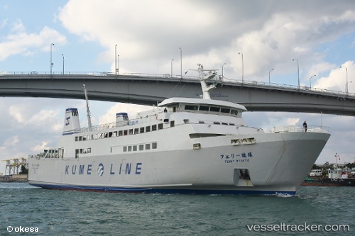
Ferry Ryukyu
Current StatusWhere is the vessel?
Ferry Ryukyu is currently in Near Naha, based on AIS data received less than 1h ago.
Latest AIS update:
Current position: 26.22432° N, 127.68211° E (Near Naha)
Average speed (last 7 days): Loading…
Average speed (last 30 days): Loading…
Vessel profile: Ferry Ryukyu is a Passenger Ro Ro Cargo Ship with dimensions 14m x 84m.
This page combines live AIS, route history, probable destination signals, nearby traffic, and port activity for practical vessel monitoring.
The current position of vessel Ferry Ryukyu is 26.22432 lat / 127.68211 lng. Updated: 2026-05-13 12:09:37 UTCNearest reference points:
- 18 nm W of Koniya
- 77 nm SE of Miyakojima
Details:
Live Vessel Ferry Ryukyu Analytics (details, animations, etc.)
Recent AIS points (UTC):
2026-05-13 07:21:42 UTC · 26.25960, 127.46948 · SOG 19.5 kn · COG 105°2026-05-13 09:35:37 UTC · 26.22434, 127.68211 · SOG 0 kn · COG 170°
2026-05-13 10:09:38 UTC · 26.22431, 127.68208 · SOG 0.1 kn · COG 170°
2026-05-13 12:09:37 UTC · 26.22432, 127.68211 · SOG 0 kn · COG 170°