 vesseltracker.com
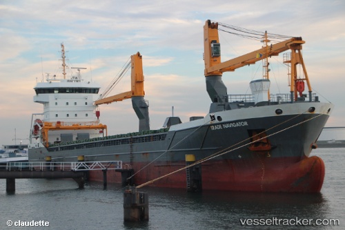
 Trade Navigator
Current Status
Where is the vessel?
Trade Navigator is currently in 13 nm W of RORO, based on AIS data received less than 1h ago.
Latest AIS update:
Current position: 57.72023° N, 11.22512° E (13 nm W of RORO)
Average speed (last 7 days): Loading…
Average speed (last 30 days): Loading…
Vessel profile: Trade Navigator is a General Cargo Ship with dimensions 118m x 16m.
This page combines live AIS, route history, probable destination signals, nearby traffic, and port activity for practical vessel monitoring.
The current position of vessel Trade Navigator is 57.72023 lat / 11.22512 lng. Updated: 2026-05-12 23:29:49 UTCNearest reference points:
- 12 nm SW of Vrångö
- 11 nm SW of Vrångö
- Near Rönnäng
Currently sailing under the flag of Netherlands ![]()
Details:
Live Vessel Trade Navigator Analytics (details, animations, etc.)
Recent AIS points (UTC):
2026-05-12 19:59:15 UTC · 57.58375, 11.68788 · SOG 0 kn · COG 330°2026-05-12 21:51:26 UTC · 57.58508, 11.68623 · SOG 0.1 kn · COG 358°
2026-05-12 22:27:29 UTC · 57.61642, 11.53918 · SOG 11.9 kn · COG 302°
2026-05-12 23:29:49 UTC · 57.72023, 11.22512 · SOG 11.8 kn · COG 303°