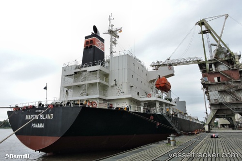
Martin Island
Current StatusWhere is the vessel?
Martin Island is currently in Near Saigon Petro Oil Terminal, based on AIS data received about 15h ago.
Latest AIS update:
Current position: 10.74941° N, 106.77430° E (Near Saigon Petro Oil Terminal)
Average speed (last 7 days): Loading…
Average speed (last 30 days): Loading…
Vessel profile: Martin Island is a General Cargo Ship with dimensions 29m x 180m.
This page combines live AIS, route history, probable destination signals, nearby traffic, and port activity for practical vessel monitoring.
The current position of vessel Martin Island is 10.74941 lat / 106.77430 lng. Updated: 2026-07-02 10:04:58 UTCNearest reference points:
- Near Cat Lai Oil Port
- Near Saigon Petro Oil Terminal
- Near Nha Be
Details:
Live Vessel Martin Island Analytics (details, animations, etc.)
Recent AIS points (UTC):
2026-07-02 07:23:15 UTC · 10.74920, 106.77447 · SOG 0.2 kn · COG 241°2026-07-02 08:17:27 UTC · 10.74956, 106.77430 · SOG 0.1 kn · COG 234°
2026-07-02 10:03:18 UTC · 10.74943, 106.77429 · SOG 0 kn · COG 234°
2026-07-02 10:04:58 UTC · 10.74941, 106.77430 · SOG 0 kn · COG 233°