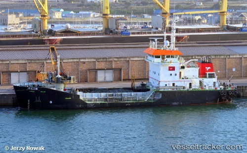
 ITALENI
Current Status
Where is the vessel?
ITALENI is currently in Near East London, based on AIS data received about 14h ago.
Latest AIS update:
Current position: 33.02389° S, 27.90530° E (Near East London)
Average speed (last 7 days): Loading…
Average speed (last 30 days): Loading…
Vessel profile: ITALENI is a Grab Hopper Dredger with dimensions m x m.
This page combines live AIS, route history, probable destination signals, nearby traffic, and port activity for practical vessel monitoring.
The current position of vessel ITALENI is -33.02389 lat / 27.90530 lng. Updated: 2026-05-21 02:07:01 UTCNearest reference points:
- Near Deal Party
- 23 nm E of Port Saint John's
- 21 nm S of Mount Pleasant
Currently sailing under the flag of South Africa ![]()
Details:
Live Vessel ITALENI Analytics (details, animations, etc.)
Recent AIS points (UTC):
2026-05-20 22:16:04 UTC · -33.02393, 27.90532 · SOG 0 kn · COG 118°2026-05-21 00:19:08 UTC · -33.02392, 27.90531 · SOG 0 kn · COG 118°
2026-05-21 01:01:06 UTC · -33.02392, 27.90531 · SOG 0 kn · COG 118°
2026-05-21 02:07:01 UTC · -33.02389, 27.90530 · SOG 0 kn · COG 118°