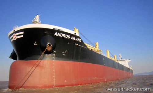
Andros Island
Current StatusWhere is the vessel?
Andros Island is currently in 75 nm SW of Trebnje, based on AIS data received about 14h ago.
Latest AIS update:
Current position: 45.05916° N, 149.93550° E (75 nm SW of Trebnje)
Average speed (last 7 days): Loading…
Average speed (last 30 days): Loading…
Vessel profile: Andros Island is a Bulk Carrier with dimensions 32m x 199m.
This page combines live AIS, route history, probable destination signals, nearby traffic, and port activity for practical vessel monitoring.
The current position of vessel Andros Island is 45.05916 lat / 149.93550 lng. Updated: 2026-05-21 04:24:35 UTCDetails:
Live Vessel Andros Island Analytics (details, animations, etc.)
Recent AIS points (UTC):
2026-05-21 01:16:44 UTC · 44.64750, 149.25406 · SOG 12.5 kn · COG 50°2026-05-21 01:27:34 UTC · 44.67119, 149.29494 · SOG 12.4 kn · COG 48°
2026-05-21 03:33:44 UTC · 44.95665, 149.74478 · SOG 11.8 kn · COG 48°
2026-05-21 04:24:35 UTC · 45.05916, 149.93550 · SOG 12.3 kn · COG 51°