 Orion Highway
Current Status
Where is the vessel?
Orion Highway is currently in 335 nm N of Tinaquillo, based on AIS data received about 15h ago.
Latest AIS update:
Current position: 15.15129° N, 66.30888° E (335 nm N of Tinaquillo)
Average speed (last 7 days): Loading…
Average speed (last 30 days): Loading…
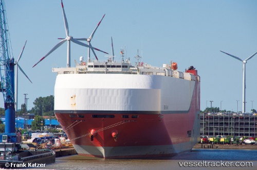
Vessel profile: Orion Highway is a Vehicles Carrier with dimensions 199m x 37m.
This page combines live AIS, route history, probable destination signals, nearby traffic, and port activity for practical vessel monitoring.
The current position of vessel Orion Highway is 15.15129 lat / 66.30888 lng. Updated: 2026-05-24 17:00:42 UTCNearest reference points:
- Open sea, approx. 401 nm off the nearest listed port
- Open sea, approx. 403 nm off the nearest listed port
- Open sea, approx. 404 nm off the nearest listed port
Currently sailing under the flag of Panama ![]()
Details:
Live Vessel Orion Highway Analytics (details, animations, etc.)
Recent AIS points (UTC):
2026-05-24 09:42:38 UTC · 13.65966, 65.95354 · SOG 12.4 kn · COG 10°2026-05-24 09:42:38 UTC · 13.65966, 65.95354 · SOG 12.4 kn · COG 10°
2026-05-24 16:15:08 UTC · 14.99770, 66.27374 · SOG 12.5 kn · COG 10°
2026-05-24 17:00:42 UTC · 15.15129, 66.30888 · SOG 12.3 kn · COG 8°