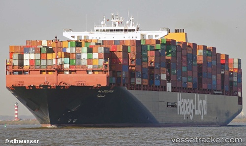
 AL JMELIYAH
Current Status
Where is the vessel?
AL JMELIYAH is currently in 13 nm NE of Ceuta, based on AIS data received about 14h ago.
Latest AIS update:
Current position: 36.01634° N, 5.09467° W (13 nm NE of Ceuta)
Average speed (last 7 days): Loading…
Average speed (last 30 days): Loading…
Vessel profile: AL JMELIYAH is a Cargo A with dimensions m x m.
This page combines live AIS, route history, probable destination signals, nearby traffic, and port activity for practical vessel monitoring.
The current position of vessel AL JMELIYAH is 36.01634 lat / -5.09467 lng. Updated: 2026-05-21 00:15:52 UTCNearest reference points:
- Near Waterport
- Near La Línea de la Concepción
- Near Sotogrande
Currently sailing under the flag of Germany ![]()
Details:
Live Vessel AL JMELIYAH Analytics (details, animations, etc.)
Recent AIS points (UTC):
2026-05-20 17:33:04 UTC · 34.94891, -7.08267 · SOG 17.6 kn · COG 44°2026-05-20 22:05:28 UTC · 35.90299, -5.93594 · SOG 18.2 kn · COG 77°
2026-05-20 22:12:22 UTC · 35.91041, -5.89354 · SOG 18.4 kn · COG 83°
2026-05-21 00:15:52 UTC · 36.01634, -5.09467 · SOG 18.2 kn · COG 89°