 vesseltracker.com
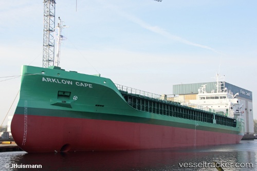
 Arklow Cape
Current Status
Where is the vessel?
Arklow Cape is currently in Near Sunderland, based on AIS data received less than 1h ago.
Latest AIS update:
Current position: 54.90500° N, 1.36167° W (Near Sunderland)
Average speed (last 7 days): Loading…
Average speed (last 30 days): Loading…
Vessel profile: Arklow Cape is a Multi Purpose Carrier with dimensions 87m x 15m.
This page combines live AIS, route history, probable destination signals, nearby traffic, and port activity for practical vessel monitoring.
The current position of vessel Arklow Cape is 54.90500 lat / -1.36167 lng. Updated: 2026-05-12 20:03:02 UTCNearest reference points:
- Near TYNE
- Near Blyth
- Near Hessle/Hull
Currently sailing under the flag of Ireland ![]()
Details:
Live Vessel Arklow Cape Analytics (details, animations, etc.)
Recent AIS points (UTC):
2026-05-12 16:17:31 UTC · 54.90500, -1.36167 · SOG 0 kn · COG -1°2026-05-12 17:56:47 UTC · 54.90500, -1.36167 · SOG 0 kn · COG -1°
2026-05-12 19:11:57 UTC · 54.90500, -1.36167 · SOG 0 kn · COG -1°
2026-05-12 20:03:02 UTC · 54.90500, -1.36167 · SOG 0 kn · COG -1°