 vesseltracker.com
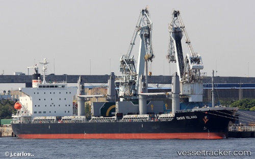
 Oasis Island
Current Status
Where is the vessel?
Oasis Island is currently in Near KIMITSU, based on AIS data received about 8h ago.
Latest AIS update:
Current position: 35.36057° N, 139.84753° E (Near KIMITSU)
Average speed (last 7 days): Loading…
Average speed (last 30 days): Loading…
Vessel profile: Oasis Island is a Bulk Carrier with dimensions 180m x 30m.
This page combines live AIS, route history, probable destination signals, nearby traffic, and port activity for practical vessel monitoring.
The current position of vessel Oasis Island is 35.36057 lat / 139.84753 lng. Updated: 2026-04-10 08:21:51 UTCNearest reference points:
- Near Yokosuka
- Near Kawasaki
- Near Naka-Ku, Kanagawa
Currently sailing under the flag of Panama ![]()
Details:
Live Vessel Oasis Island Analytics (details, animations, etc.)
Recent AIS points (UTC):
2026-04-10 01:51:51 UTC · 35.36051, 139.84766 · SOG 0 kn · COG 125°2026-04-10 03:54:52 UTC · 35.36055, 139.84766 · SOG 0.1 kn · COG 125°
2026-04-10 05:42:51 UTC · 35.36058, 139.84761 · SOG 0 kn · COG 125°
2026-04-10 08:21:51 UTC · 35.36057, 139.84753 · SOG 0 kn · COG 125°