 vesseltracker.com
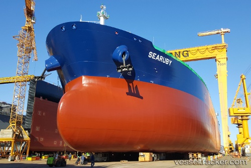
Searuby
Current StatusWhere is the vessel?
Searuby is currently in 210 nm NE of Munshiganj, based on AIS data received less than 1h ago.
Latest AIS update:
Current position: 25.62833° N, 87.44833° W (210 nm NE of Munshiganj)
Average speed (last 7 days): Loading…
Average speed (last 30 days): Loading…
Vessel profile: Searuby is a Crude Oil Tanker with dimensions 44m x 250m.
This page combines live AIS, route history, probable destination signals, nearby traffic, and port activity for practical vessel monitoring.
The current position of vessel Searuby is 25.62833 lat / -87.44833 lng. Updated: 2026-05-15 16:15:56 UTCDetails:
Live Vessel Searuby Analytics (details, animations, etc.)
Recent AIS points (UTC):
2026-05-15 13:45:54 UTC · 25.18667, -87.20667 · SOG 11 kn · COG -1°2026-05-15 13:45:54 UTC · 25.18667, -87.20667 · SOG 11 kn · COG -1°
2026-05-15 16:06:56 UTC · 25.60167, -87.43333 · SOG 11 kn · COG -1°
2026-05-15 16:15:56 UTC · 25.62833, -87.44833 · SOG 11 kn · COG -1°