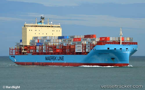
 Volga Maersk
Current Status
Where is the vessel?
Volga Maersk is currently in 24 nm SW of Ruan Minor, based on AIS data received about 14h ago.
Latest AIS update:
Current position: 49.62225° N, 5.44855° W (24 nm SW of Ruan Minor)
Average speed (last 7 days): Loading…
Average speed (last 30 days): Loading…
Vessel profile: Volga Maersk is a Container Ship with dimensions 200m x 200m.
This page combines live AIS, route history, probable destination signals, nearby traffic, and port activity for practical vessel monitoring.
The current position of vessel Volga Maersk is 49.62225 lat / -5.44855 lng. Updated: 2026-05-20 00:10:39 UTCNearest reference points:
- 28 nm S of Porthgwarra
- Near Cadgwith
- Near Flushing
Currently sailing under the flag of Denmark ![]()
Details:
Live Vessel Volga Maersk Analytics (details, animations, etc.)
Recent AIS points (UTC):
2026-05-19 19:51:29 UTC · 49.63063, -6.53197 · SOG 10.7 kn · COG 91°2026-05-19 22:13:13 UTC · 49.63218, -5.91367 · SOG 9.8 kn · COG 90°
2026-05-19 23:07:19 UTC · 49.62365, -5.69478 · SOG 9.3 kn · COG 88°
2026-05-20 00:10:39 UTC · 49.62225, -5.44855 · SOG 9.1 kn · COG 89°