 vesseltracker.com
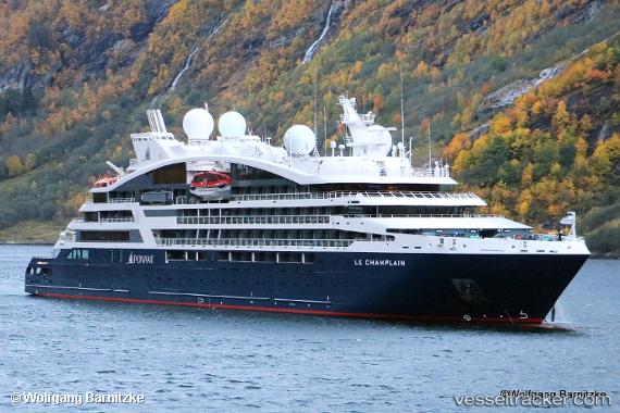
 Le Champlain
Current Status
Where is the vessel?
Le Champlain is currently in Near TERRE DE HAUT, based on AIS data received about 1h ago.
Latest AIS update:
Current position: 15.86909° N, 61.59544° W (Near TERRE DE HAUT)
Average speed (last 7 days): Loading…
Average speed (last 30 days): Loading…
Vessel profile: Le Champlain is a Cruise Ship with dimensions 131m x 18m.
This page combines live AIS, route history, probable destination signals, nearby traffic, and port activity for practical vessel monitoring.
The current position of vessel Le Champlain is 15.86909 lat / -61.59544 lng. Updated: 2026-04-05 13:26:48 UTCNearest reference points:
- Near Le Gosier
- Near Pointe A Pitre
- Near ANTIGUA
Currently sailing under the flag of Wallis Futuna Is ![]()
Details:
Live Vessel Le Champlain Analytics (details, animations, etc.)
Recent AIS points (UTC):
2026-04-05 08:25:26 UTC · 15.39619, -61.48436 · SOG 10.3 kn · COG 343°2026-04-05 09:26:46 UTC · 15.56830, -61.54174 · SOG 10.5 kn · COG 340°
2026-04-05 11:33:55 UTC · 15.86904, -61.59349 · SOG 0.3 kn · COG 82°
2026-04-05 13:26:48 UTC · 15.86909, -61.59544 · SOG 0.6 kn · COG 88°