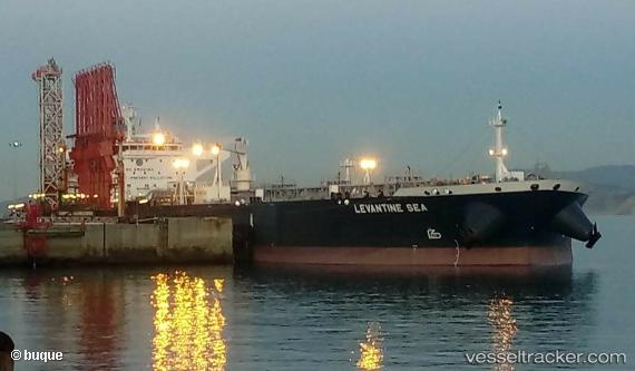
Levantine Sea
Current StatusWhere is the vessel?
Levantine Sea is currently in 53 nm NW of PUERTO BOLIVAR, based on AIS data received about 14h ago.
Latest AIS update:
Current position: 12.72166° N, 72.72500° W (53 nm NW of PUERTO BOLIVAR)
Average speed (last 7 days): Loading…
Average speed (last 30 days): Loading…
Vessel profile: Levantine Sea is a Crude Oil Tanker with dimensions 44m x 250m.
This page combines live AIS, route history, probable destination signals, nearby traffic, and port activity for practical vessel monitoring.
The current position of vessel Levantine Sea is 12.72166 lat / -72.72500 lng. Updated: 2026-05-21 04:22:33 UTCNearest reference points:
- Near PUERTO BOLIVAR
- 18 nm N of Santa Marta
- Near Santa Marta
Details:
Live Vessel Levantine Sea Analytics (details, animations, etc.)
Recent AIS points (UTC):
2026-05-21 01:58:31 UTC · 12.50167, -73.09667 · SOG 10 kn · COG -1°2026-05-21 02:13:32 UTC · 12.52333, -73.05833 · SOG 10 kn · COG -1°
2026-05-21 03:41:30 UTC · 12.65997, -72.83234 · SOG 10.5 kn · COG 60°
2026-05-21 04:22:33 UTC · 12.72166, -72.72500 · SOG 10 kn · COG -1°