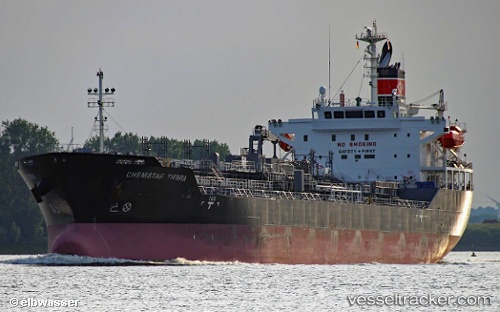
 Chemstar Tierra
Current Status
Where is the vessel?
Chemstar Tierra is currently in Near Port-Alfred, based on AIS data received about 14h ago.
Latest AIS update:
Current position: 48.33995° N, 70.86297° W (Near Port-Alfred)
Average speed (last 7 days): Loading…
Average speed (last 30 days): Loading…
Vessel profile: Chemstar Tierra is a Chemical Oil Products Tanker with dimensions 149m x 24m.
This page combines live AIS, route history, probable destination signals, nearby traffic, and port activity for practical vessel monitoring.
The current position of vessel Chemstar Tierra is 48.33995 lat / -70.86297 lng. Updated: 2026-05-19 23:00:07 UTCNearest reference points:
- Near Ile Aux Coudres
- Near QUEBEC
- 15 nm NW of Saint-Anaclet
Currently sailing under the flag of Panama ![]()
Details:
Live Vessel Chemstar Tierra Analytics (details, animations, etc.)
Recent AIS points (UTC):
2026-05-19 19:57:07 UTC · 48.34032, -70.86317 · SOG 0 kn · COG 67°2026-05-19 20:24:07 UTC · 48.34017, -70.86307 · SOG 0.1 kn · COG 64°
2026-05-19 22:03:07 UTC · 48.34051, -70.86341 · SOG 0.1 kn · COG 74°
2026-05-19 23:00:07 UTC · 48.33995, -70.86297 · SOG 0.1 kn · COG 54°