 vesseltracker.com
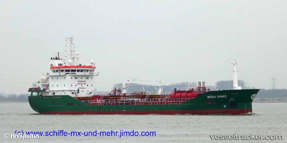
 MINA DENIZ
Current Status
Where is the vessel?
MINA DENIZ is currently in Near Borgo, based on AIS data received less than 1h ago.
Latest AIS update:
Current position: 42.57233° N, 9.61201° E (Near Borgo)
Average speed (last 7 days): Loading…
Average speed (last 30 days): Loading…
Vessel profile: MINA DENIZ is a Chemical/Oil Products Tanker with dimensions 16m x 110m.
This page combines live AIS, route history, probable destination signals, nearby traffic, and port activity for practical vessel monitoring.
The current position of vessel MINA DENIZ is 42.57233 lat / 9.61201 lng. Updated: 2026-05-15 03:54:26 UTCNearest reference points:
- 12 nm NE of Bastia
- 12 nm N of Macinaggio
- 26 nm W of Macinaggio
Currently sailing under the flag of Malta ![]()
MINA DENIZ built in 2019 year
Deadweight:
6610 tDetails:
Live Vessel MINA DENIZ Analytics (details, animations, etc.)
Recent AIS points (UTC):
2026-05-14 22:27:24 UTC · 42.57232, 9.61238 · SOG 0 kn · COG 319°2026-05-14 23:57:19 UTC · 42.57237, 9.61246 · SOG 0 kn · COG 316°
2026-05-15 01:15:23 UTC · 42.57242, 9.61220 · SOG 0 kn · COG 311°
2026-05-15 03:54:26 UTC · 42.57233, 9.61201 · SOG 0 kn · COG 320°