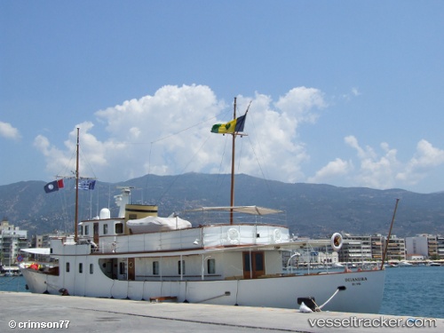
 Deianeira
Current Status
Where is the vessel?
Deianeira is currently in Near CALA DEL FORTE, based on AIS data received about 14h ago.
Latest AIS update:
Current position: 43.78919° N, 7.59825° E (Near CALA DEL FORTE)
Average speed (last 7 days): Loading…
Average speed (last 30 days): Loading…
Vessel profile: Deianeira is a General Cargo Ship with dimensions 35m x 6m.
This page combines live AIS, route history, probable destination signals, nearby traffic, and port activity for practical vessel monitoring.
The current position of vessel Deianeira is 43.78919 lat / 7.59825 lng. Updated: 2026-05-25 11:13:58 UTCNearest reference points:
- Near SANREMO
- Near Monaco
- Near Monte-Carlo
Currently sailing under the flag of St Vincent Grenadines ![]()
Details:
Live Vessel Deianeira Analytics (details, animations, etc.)
Recent AIS points (UTC):
2026-05-25 07:22:44 UTC · 43.78916, 7.59824 · SOG 0 kn · COG -1°2026-05-25 07:45:56 UTC · 43.78918, 7.59825 · SOG 0 kn · COG -1°
2026-05-25 10:05:57 UTC · 43.78920, 7.59824 · SOG 0 kn · COG -1°
2026-05-25 11:13:58 UTC · 43.78919, 7.59825 · SOG 0 kn · COG -1°