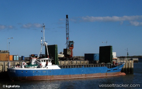
 Helios2
Current Status
Where is the vessel?
Helios2 is currently in Near Saint Michaels, based on AIS data received about 14h ago.
Latest AIS update:
Current position: 38.78817° N, 76.21057° W (Near Saint Michaels)
Average speed (last 7 days): Loading…
Average speed (last 30 days): Loading…
Vessel profile: Helios2 is a Service Ship with dimensions 49m x 10m.
This page combines live AIS, route history, probable destination signals, nearby traffic, and port activity for practical vessel monitoring.
The current position of vessel Helios2 is 38.78817 lat / -76.21057 lng. Updated: 2026-05-19 04:34:56 UTCNearest reference points:
- Near Annapolis
- Near Tracys Landing
- Near Orchard Beach
Currently sailing under the flag of Cayman Is ![]()
Details:
Live Vessel Helios2 Analytics (details, animations, etc.)
Recent AIS points (UTC):
2026-05-19 01:51:22 UTC · 38.78667, -76.21000 · SOG 0 kn · COG -1°2026-05-19 02:19:54 UTC · 38.78820, -76.21066 · SOG 0.2 kn · COG 144°
2026-05-19 04:24:22 UTC · 38.78667, -76.21000 · SOG 0 kn · COG -1°
2026-05-19 04:34:56 UTC · 38.78817, -76.21057 · SOG 0 kn · COG 179°