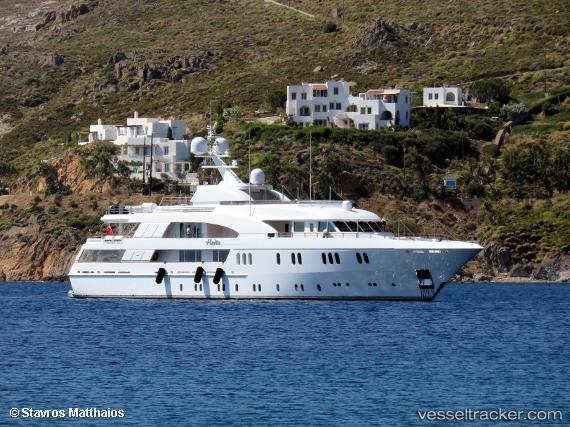
 Hadia
Hadia
Current Status
Where is the vessel?
Hadia is currently in Near PORTOCHELI, based on AIS data received about 14h ago.
Latest AIS update:
Current position: 37.32465° N, 23.14642° E (Near PORTOCHELI)
Average speed (last 7 days): Loading…
Average speed (last 30 days): Loading…
Vessel profile: Hadia is a Service Ship with dimensions 43m x 9m.
This page combines live AIS, route history, probable destination signals, nearby traffic, and port activity for practical vessel monitoring.
The current position of vessel Hadia is 37.32465 lat / 23.14642 lng. Updated: 2026-05-20 13:03:07 UTCNearest reference points:
- Near Koilas Ermionidos
- Near KOILADA
- Near Galatas Troizinas
Currently sailing under the flag of Cayman Is ![]()
Hadia built in 2006 year
Deadweight:
162 tDetails:
Live Vessel Hadia Analytics (details, animations, etc.)
Recent AIS points (UTC):
2026-05-20 10:12:10 UTC · 37.32465, 23.14642 · SOG 0 kn · COG 59°2026-05-20 10:12:10 UTC · 37.32465, 23.14642 · SOG 0 kn · COG 59°
2026-05-20 11:33:04 UTC · 37.32465, 23.14642 · SOG 0 kn · COG 58°
2026-05-20 13:03:07 UTC · 37.32465, 23.14642 · SOG 0 kn · COG 59°