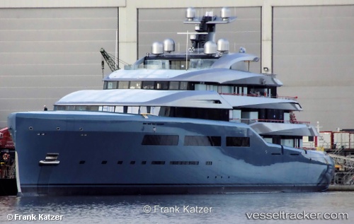
 Aviva
Aviva
Current Status
Where is the vessel?
Aviva is currently in Near SAN ADRIAN DE BESOS, based on AIS data received about 14h ago.
Latest AIS update:
Current position: 41.41293° N, 2.22982° E (Near SAN ADRIAN DE BESOS)
Average speed (last 7 days): Loading…
Average speed (last 30 days): Loading…
Vessel profile: Aviva is a Service Ship with dimensions 68m x 68m.
This page combines live AIS, route history, probable destination signals, nearby traffic, and port activity for practical vessel monitoring.
The current position of vessel Aviva is 41.41293 lat / 2.22982 lng. Updated: 2026-05-20 11:52:09 UTCNearest reference points:
- Near BADALONA
- Near Barcelona
- Near Zona Franca de Barcelona
Currently sailing under the flag of Cayman Is ![]()
Aviva built in 2007 year
Deadweight:
185 tDetails:
Live Vessel Aviva Analytics (details, animations, etc.)
Recent AIS points (UTC):
2026-05-20 08:07:09 UTC · 41.41296, 2.22982 · SOG 0 kn · COG 152°2026-05-20 09:37:12 UTC · 41.41295, 2.22983 · SOG 0 kn · COG 152°
2026-05-20 10:26:30 UTC · 41.41167, 2.22833 · SOG 0 kn · COG -1°
2026-05-20 11:52:09 UTC · 41.41293, 2.22982 · SOG 0 kn · COG 152°