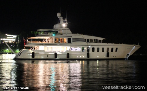
 Harle
Harle
Current Status
Where is the vessel?
Harle is currently in Near ST THOMAS, based on AIS data received about 14h ago.
Latest AIS update:
Current position: 18.33503° N, 64.92101° W (Near ST THOMAS)
Average speed (last 7 days): Loading…
Average speed (last 30 days): Loading…
Vessel profile: Harle is a Service Ship with dimensions 45m x 9m.
This page combines live AIS, route history, probable destination signals, nearby traffic, and port activity for practical vessel monitoring.
The current position of vessel Harle is 18.33503 lat / -64.92101 lng. Updated: 2026-05-22 07:05:52 UTCNearest reference points:
- Near Charlotte Amalie
- Near ST THOMAS
- Near Norman Island
Currently sailing under the flag of Cayman Is ![]()
Harle built in 2007 year
Details:
Live Vessel Harle Analytics (details, animations, etc.)
Recent AIS points (UTC):
2026-05-22 04:08:56 UTC · 18.33503, -64.92101 · SOG 0 kn · COG 305°2026-05-22 04:29:50 UTC · 18.33499, -64.92102 · SOG 0 kn · COG 305°
2026-05-22 06:05:53 UTC · 18.33504, -64.92103 · SOG 0 kn · COG 305°
2026-05-22 07:05:52 UTC · 18.33503, -64.92101 · SOG 0 kn · COG 306°