 vesseltracker.com
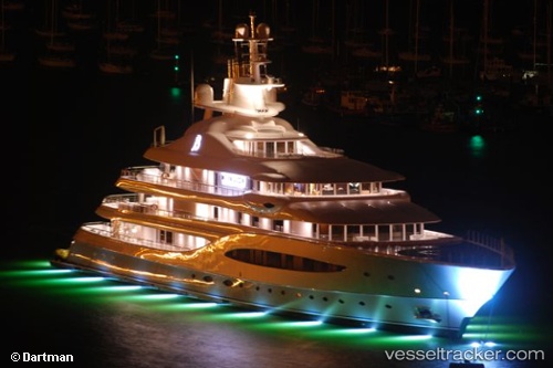
 Mayan Queen Iv
Current Status
Where is the vessel?
Mayan Queen Iv is currently in 270 nm NW of Upper Northfield, based on AIS data received about 2h ago.
Latest AIS update:
Current position: 23.78833° N, 49.29333° W (270 nm NW of Upper Northfield)
Average speed (last 7 days): Loading…
Average speed (last 30 days): Loading…
Vessel profile: Mayan Queen Iv is a Service Ship with dimensions 97m x 97m.
This page combines live AIS, route history, probable destination signals, nearby traffic, and port activity for practical vessel monitoring.
The current position of vessel Mayan Queen Iv is 23.78833 lat / -49.29333 lng. Updated: 2026-05-15 16:15:40 UTCNearest reference points:
- Open sea, approx. 403 nm off the nearest listed port
Currently sailing under the flag of Cayman Is ![]()
Mayan Queen Iv built in 2008 year
Deadweight:
530 tDetails:
Live Vessel Mayan Queen Iv Analytics (details, animations, etc.)
Recent AIS points (UTC):
2026-05-15 11:59:48 UTC · 23.24833, -50.33667 · SOG 15 kn · COG -1°2026-05-15 13:41:24 UTC · 23.46354, -49.92277 · SOG 14.5 kn · COG 63°
2026-05-15 16:13:13 UTC · 23.78318, -49.30259 · SOG 15.6 kn · COG 62°
2026-05-15 16:15:40 UTC · 23.78833, -49.29333 · SOG 16 kn · COG -1°