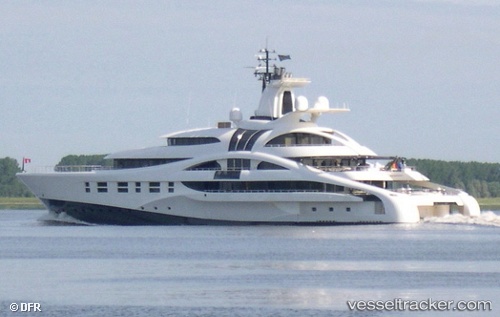
 PALLADIUM
Current Status
Where is the vessel?
PALLADIUM is currently in Near PUERTO VALLARTA, based on AIS data received about 15h ago.
Latest AIS update:
Current position: 20.65587° N, 105.24135° W (Near PUERTO VALLARTA)
Average speed (last 7 days): Loading…
Average speed (last 30 days): Loading…
Vessel profile: PALLADIUM is a Houseboat with dimensions m x m.
This page combines live AIS, route history, probable destination signals, nearby traffic, and port activity for practical vessel monitoring.
The current position of vessel PALLADIUM is 20.65587 lat / -105.24135 lng. Updated: 2026-05-27 07:56:01 UTCNearest reference points:
- Near NUEVO VALLARTA
- 35 nm S of Nayarit
Currently sailing under the flag of Cayman Islands ![]()
PALLADIUM built in 2010 year
Deadweight:
565 tDetails:
Live Vessel PALLADIUM Analytics (details, animations, etc.)
Recent AIS points (UTC):
2026-05-27 04:05:05 UTC · 20.65587, -105.24135 · SOG 0 kn · COG 214°2026-05-27 05:29:04 UTC · 20.65586, -105.24136 · SOG 0 kn · COG 214°
2026-05-27 07:17:01 UTC · 20.65587, -105.24135 · SOG 0 kn · COG 214°
2026-05-27 07:56:01 UTC · 20.65587, -105.24135 · SOG 0 kn · COG 215°