 vesseltracker.com
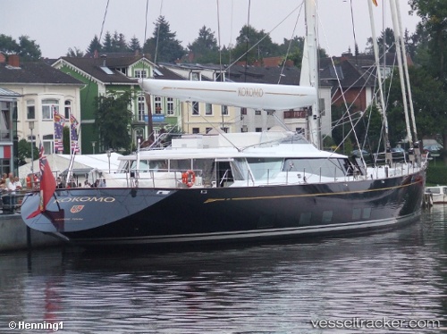
 Sy Kokomo
Current Status
Where is the vessel?
Sy Kokomo is currently in Near Tahiti Fa'a'à, based on AIS data received about 1h ago.
Latest AIS update:
Current position: 17.58499° S, 149.61710° W (Near Tahiti Fa'a'à)
Average speed (last 7 days): Loading…
Average speed (last 30 days): Loading…
Vessel profile: Sy Kokomo is a Service Ship with dimensions 59m x 59m.
This page combines live AIS, route history, probable destination signals, nearby traffic, and port activity for practical vessel monitoring.
The current position of vessel Sy Kokomo is -17.58499 lat / -149.61710 lng. Updated: 2026-04-28 20:02:30 UTCNearest reference points:
- 12 nm E of Papara
Currently sailing under the flag of Cayman Is ![]()
Sy Kokomo built in 2010 year
Deadweight:
95 tDetails:
Live Vessel Sy Kokomo Analytics (details, animations, etc.)
Recent AIS points (UTC):
2026-04-28 16:04:00 UTC · -17.58490, -149.61700 · SOG 0 kn · COG 260°2026-04-28 16:11:55 UTC · -17.58490, -149.61700 · SOG 0 kn · COG 260°
2026-04-28 17:55:56 UTC · -17.58500, -149.61700 · SOG 0 kn · COG 260°
2026-04-28 20:02:30 UTC · -17.58499, -149.61710 · SOG 0 kn · COG 260°