 vesseltracker.com
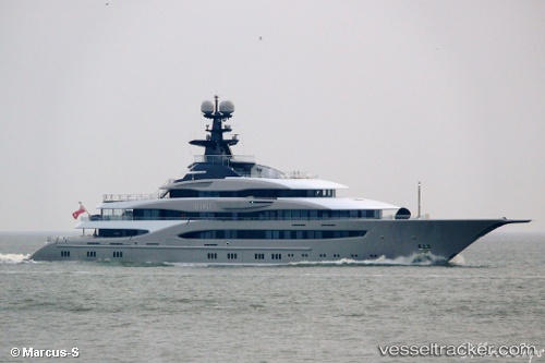
 WHISPER
Current Status
Where is the vessel?
WHISPER is currently in 99 nm SW of Sagres, based on AIS data received about 14h ago.
Latest AIS update:
Current position: 36.31667° N, 10.81500° W (99 nm SW of Sagres)
Average speed (last 7 days): Loading…
Average speed (last 30 days): Loading…
Vessel profile: WHISPER is a Pleasure Craft with dimensions m x m.
This page combines live AIS, route history, probable destination signals, nearby traffic, and port activity for practical vessel monitoring.
The current position of vessel WHISPER is 36.31667 lat / -10.81500 lng. Updated: 2026-05-17 22:16:52 UTCNearest reference points:
- 54 nm W of Sagres
- 31 nm SW of Sagres
- 118 nm NE of Nedroma
Currently sailing under the flag of Marshall Islands ![]()
Details:
Live Vessel WHISPER Analytics (details, animations, etc.)
Recent AIS points (UTC):
2026-05-17 19:34:52 UTC · 36.38167, -11.60500 · SOG 14 kn · COG -1°2026-05-17 19:43:53 UTC · 36.37833, -11.56167 · SOG 14 kn · COG -1°
2026-05-17 22:01:51 UTC · 36.32167, -10.88667 · SOG 14 kn · COG -1°
2026-05-17 22:16:52 UTC · 36.31667, -10.81500 · SOG 14 kn · COG -1°