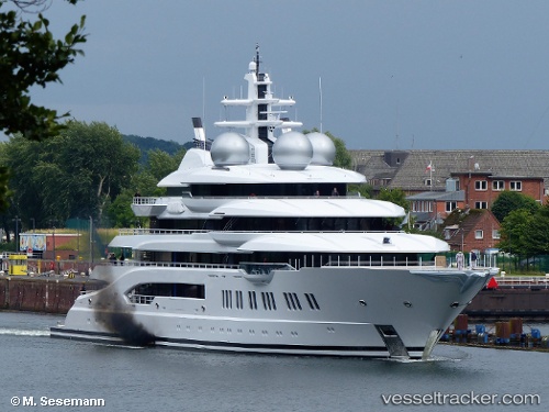
 MY AMADEA
Current Status
Where is the vessel?
MY AMADEA is currently in Near Èze, based on AIS data received about 14h ago.
Latest AIS update:
Current position: 43.71324° N, 7.37420° E (Near Èze)
Average speed (last 7 days): Loading…
Average speed (last 30 days): Loading…
Vessel profile: MY AMADEA is a Pleasure Craft with dimensions m x m.
This page combines live AIS, route history, probable destination signals, nearby traffic, and port activity for practical vessel monitoring.
The current position of vessel MY AMADEA is 43.71324 lat / 7.37420 lng. Updated: 2026-06-15 09:59:30 UTCNearest reference points:
- Near Beaulieu-sur-Mer
- Near SAINTJEAN CAP FERRAT
- Near Monte-Carlo
Currently sailing under the flag of Cayman Islands ![]()
Details:
Live Vessel MY AMADEA Analytics (details, animations, etc.)
Recent AIS points (UTC):
2026-06-15 07:17:30 UTC · 43.71309, 7.37423 · SOG 0.1 kn · COG 143°2026-06-15 08:20:24 UTC · 43.71292, 7.37425 · SOG 0.1 kn · COG 116°
2026-06-15 09:59:30 UTC · 43.71324, 7.37420 · SOG 0.2 kn · COG 78°
2026-06-15 09:59:30 UTC · 43.71324, 7.37420 · SOG 0.2 kn · COG 78°