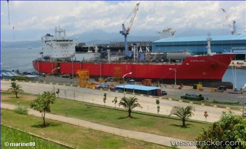
Kaprijke
Current StatusWhere is the vessel?
Kaprijke is currently in Near Texas City, based on AIS data received about 14h ago.
Latest AIS update:
Current position: 29.36050° N, 94.91305° W (Near Texas City)
Average speed (last 7 days): Loading…
Average speed (last 30 days): Loading…
Vessel profile: Kaprijke is a Lpg Tanker with dimensions 30m x 180m.
This page combines live AIS, route history, probable destination signals, nearby traffic, and port activity for practical vessel monitoring.
The current position of vessel Kaprijke is 29.36050 lat / -94.91305 lng. Updated: 2026-05-21 06:34:25 UTCNearest reference points:
- Near Texas City
- Near Port Bolivar
- Near Clear Lake Shores
Details:
Live Vessel Kaprijke Analytics (details, animations, etc.)
Recent AIS points (UTC):
2026-05-21 02:19:46 UTC · 29.36050, -94.91305 · SOG 0 kn · COG 359°2026-05-21 04:13:37 UTC · 29.36050, -94.91305 · SOG 0 kn · COG 0°
2026-05-21 04:49:21 UTC · 29.36051, -94.91305 · SOG 0 kn · COG 0°
2026-05-21 06:34:25 UTC · 29.36050, -94.91305 · SOG 0 kn · COG 0°