 vesseltracker.com
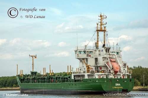
Dina
Current StatusWhere is the vessel?
Dina is currently in 20 nm NE of Grena, based on AIS data received less than 1h ago.
Latest AIS update:
Current position: 56.70708° N, 11.22922° E (20 nm NE of Grena)
Average speed (last 7 days): Loading…
Average speed (last 30 days): Loading…
Vessel profile: Dina is a Multi Purpose Carrier with dimensions 16m x 100m.
This page combines live AIS, route history, probable destination signals, nearby traffic, and port activity for practical vessel monitoring.
The current position of vessel Dina is 56.70708 lat / 11.22922 lng. Updated: 2026-05-14 16:17:18 UTCNearest reference points:
- Near Grena
- Near Glesborg
- 19 nm E of Sæby
Details:
Live Vessel Dina Analytics (details, animations, etc.)
Recent AIS points (UTC):
2026-05-14 13:44:06 UTC · 56.43717, 11.83027 · SOG 9.6 kn · COG 306°2026-05-14 14:05:38 UTC · 56.47157, 11.74371 · SOG 9.9 kn · COG 304°
2026-05-14 16:07:08 UTC · 56.68597, 11.26522 · SOG 10.2 kn · COG 315°
2026-05-14 16:17:18 UTC · 56.70708, 11.22922 · SOG 10.2 kn · COG 315°