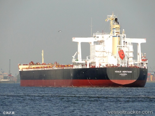
 Venus Heritage
Current Status
Where is the vessel?
Venus Heritage is currently in 11 nm E of Richards Bay, based on AIS data received about 14h ago.
Latest AIS update:
Current position: 28.82340° S, 32.33176° E (11 nm E of Richards Bay)
Average speed (last 7 days): Loading…
Average speed (last 30 days): Loading…
Vessel profile: Venus Heritage is a Bulk Carrier with dimensions 235m x 38m.
This page combines live AIS, route history, probable destination signals, nearby traffic, and port activity for practical vessel monitoring.
The current position of vessel Venus Heritage is -28.82340 lat / 32.33176 lng. Updated: 2026-07-25 10:15:14 UTCNearest reference points:
- 42 nm E of Richards Bay
- Near Umhlanga Rocks
- Near Durban
Currently sailing under the flag of Cyprus ![]()
Venus Heritage built in 2010 year
Deadweight:
95650 tDetails:
Live Vessel Venus Heritage Analytics (details, animations, etc.)
Recent AIS points (UTC):
2026-07-25 07:55:08 UTC · -28.82177, 32.04588 · SOG 0 kn · COG 30°2026-07-25 08:10:08 UTC · -28.82182, 32.04586 · SOG 0 kn · COG 30°
2026-07-25 09:25:18 UTC · -28.82155, 32.17416 · SOG 9 kn · COG 76°
2026-07-25 10:15:14 UTC · -28.82340, 32.33176 · SOG 9.8 kn · COG 91°