 vesseltracker.com
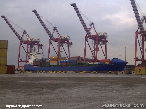
 Gabriel A
Current Status
Where is the vessel?
Gabriel A is currently in Near Rijeka, based on AIS data received about 1d ago.
Latest AIS update:
Current position: 45.27930° N, 14.40490° E (Near Rijeka)
Average speed (last 7 days): Loading…
Average speed (last 30 days): Loading…
Vessel profile: Gabriel A is a Container Ship with dimensions 155m x 25m.
This page combines live AIS, route history, probable destination signals, nearby traffic, and port activity for practical vessel monitoring.
The current position of vessel Gabriel A is 45.2793 lat / 14.4049 lng. Updated: 2026-04-10 07:25:44 UTCNearest reference points:
- Near Rijeka
- Near VALBISKA
- Near Pula
Currently sailing under the flag of Malta ![]()
Gabriel A built in 2004 year
Deadweight:
17264 tDetails:
Live Vessel Gabriel A Analytics (details, animations, etc.)
Recent AIS points (UTC):
2026-04-10 02:25:46 UTC · 45.27960, 14.40460 · SOG 0 kn · COG 355°2026-04-10 03:49:44 UTC · 45.27970, 14.40460 · SOG 0 kn · COG 4°
2026-04-10 05:58:43 UTC · 45.27970, 14.40470 · SOG 0 kn · COG 344°
2026-04-10 07:25:44 UTC · 45.27930, 14.40490 · SOG 0.1 kn · COG 356°