 vesseltracker.com
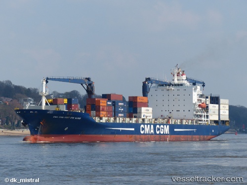
 Cmacgm Fort St Marie
Current Status
Where is the vessel?
Cmacgm Fort St Marie is currently in Near Al Latakia, based on AIS data received about 1h ago.
Latest AIS update:
Current position: 35.52170° N, 35.74470° E (Near Al Latakia)
Average speed (last 7 days): Loading…
Average speed (last 30 days): Loading…
Vessel profile: Cmacgm Fort St Marie is a Container Ship with dimensions 197m x 30m.
This page combines live AIS, route history, probable destination signals, nearby traffic, and port activity for practical vessel monitoring.
The current position of vessel Cmacgm Fort St Marie is 35.5217 lat / 35.7447 lng. Updated: 2026-04-02 09:44:04 UTCNearest reference points:
- Near Al Latakia
- Near Al Ladhiqiyah
- Near Tartous
Currently sailing under the flag of Malta ![]()
Cmacgm Fort St Marie built in 2003 year
Deadweight:
30804 tDetails:
Live Vessel Cmacgm Fort St Marie Analytics (details, animations, etc.)
Recent AIS points (UTC):
2026-04-02 04:20:53 UTC · 35.49490, 35.47940 · SOG 4.7 kn · COG 31°2026-04-02 05:23:14 UTC · 35.52320, 35.55520 · SOG 4.2 kn · COG 90°
2026-04-02 07:32:02 UTC · 35.52000, 35.74260 · SOG 0 kn · COG 92°
2026-04-02 09:44:04 UTC · 35.52170, 35.74470 · SOG 0 kn · COG 182°