 vesseltracker.com
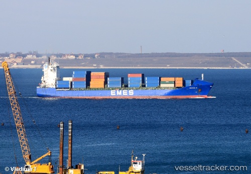
 Yigitcan A
Current Status
Where is the vessel?
Yigitcan A is currently in Near Al Latakia, based on AIS data received about 1h ago.
Latest AIS update:
Current position: 35.52670° N, 35.76830° E (Near Al Latakia)
Average speed (last 7 days): Loading…
Average speed (last 30 days): Loading…
Vessel profile: Yigitcan A is a Container Ship with dimensions 156m x 25m.
This page combines live AIS, route history, probable destination signals, nearby traffic, and port activity for practical vessel monitoring.
The current position of vessel Yigitcan A is 35.5267 lat / 35.7683 lng. Updated: 2026-04-18 13:40:26 UTCNearest reference points:
- Near Al Latakia
- Near Al Ladhiqiyah
- Near Tartous
Currently sailing under the flag of Malta ![]()
Yigitcan A built in 2001 year
Deadweight:
17264 tDetails:
Live Vessel Yigitcan A Analytics (details, animations, etc.)
Recent AIS points (UTC):
2026-04-18 06:11:21 UTC · 35.52790, 35.76990 · SOG 0 kn · COG 227°2026-04-18 09:04:16 UTC · 35.52670, 35.76830 · SOG 0 kn · COG -1°
2026-04-18 11:46:25 UTC · 35.52670, 35.76830 · SOG 0 kn · COG -1°
2026-04-18 13:40:26 UTC · 35.52670, 35.76830 · SOG 0 kn · COG -1°