 vesseltracker.com
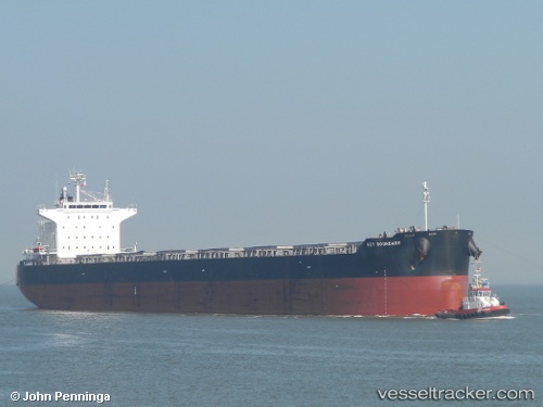
 ALLIANCE
Current Status
Where is the vessel?
ALLIANCE is currently in 171 nm W of Las Brujas, based on AIS data received less than 1h ago.
Latest AIS update:
Current position: 23.02010° N, 21.34970° W (171 nm W of Las Brujas)
Average speed (last 7 days): Loading…
Average speed (last 30 days): Loading…
Vessel profile: ALLIANCE is a Bulk Carrier with dimensions 229m x 32m.
This page combines live AIS, route history, probable destination signals, nearby traffic, and port activity for practical vessel monitoring.
The current position of vessel ALLIANCE is 23.0201 lat / -21.3497 lng. Updated: 2026-04-18 04:06:27 UTCCurrently sailing under the flag of Malta ![]()
ALLIANCE built in 2010 year
Deadweight:
83369 tDetails:
Live Vessel ALLIANCE Analytics (details, animations, etc.)
Recent AIS points (UTC):
2026-04-17 21:34:46 UTC · 22.02540, -21.83900 · SOG 9.8 kn · COG 24°2026-04-18 00:12:23 UTC · 22.43170, -21.64670 · SOG 9 kn · COG -1°
2026-04-18 01:42:22 UTC · 22.66170, -21.53500 · SOG 10 kn · COG -1°
2026-04-18 04:06:27 UTC · 23.02010, -21.34970 · SOG 9.9 kn · COG 28°