 vesseltracker.com
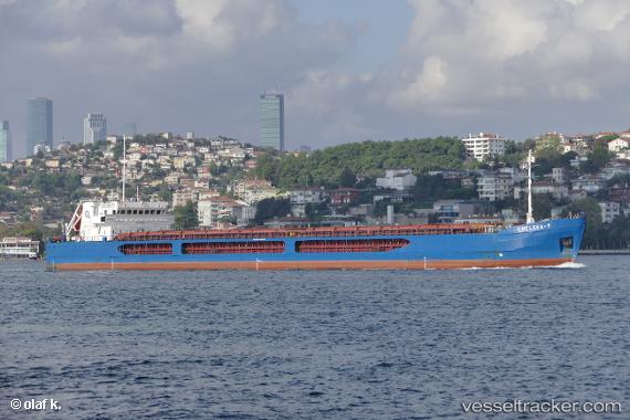
 Chelsea 7
Current Status
Where is the vessel?
Chelsea 7 is currently in Near Sulina (Port et Zone Franche), based on AIS data received less than 1h ago.
Latest AIS update:
Current position: 45.15120° N, 29.80630° E (Near Sulina (Port et Zone Franche))
Average speed (last 7 days): Loading…
Average speed (last 30 days): Loading…
Vessel profile: Chelsea 7 is a General Cargo Ship with dimensions 136m x 16m.
This page combines live AIS, route history, probable destination signals, nearby traffic, and port activity for practical vessel monitoring.
The current position of vessel Chelsea 7 is 45.1512 lat / 29.8063 lng. Updated: 2026-05-02 14:26:20 UTCNearest reference points:
- 12 nm SE of Sulina (Port et Zone Franche)
- 13 nm E of Sulina (Port et Zone Franche)
- Near Ust-Dunaisk/Vylkove
Currently sailing under the flag of Malta ![]()
Chelsea 7 built in 2010 year
Deadweight:
6320 tDetails:
Live Vessel Chelsea 7 Analytics (details, animations, etc.)
Recent AIS points (UTC):
2026-05-02 10:59:20 UTC · 45.15140, 29.80780 · SOG 0 kn · COG 354°2026-05-02 12:23:20 UTC · 45.15130, 29.80730 · SOG 0.1 kn · COG 19°
2026-05-02 13:38:19 UTC · 45.15140, 29.80710 · SOG 0.3 kn · COG 24°
2026-05-02 14:26:20 UTC · 45.15120, 29.80630 · SOG 0.2 kn · COG 26°