 vesseltracker.com
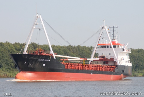
Hanne Danica
Current StatusWhere is the vessel?
Hanne Danica is currently in Near Wilmington, based on AIS data received about 1h ago.
Latest AIS update:
Current position: 34.19430° N, 77.95570° W (Near Wilmington)
Average speed (last 7 days): Loading…
Average speed (last 30 days): Loading…
Vessel profile: Hanne Danica is a General Cargo Ship with dimensions 12m x 72m.
This page combines live AIS, route history, probable destination signals, nearby traffic, and port activity for practical vessel monitoring.
The current position of vessel Hanne Danica is 34.19430 lat / -77.95570 lng. Updated: 2026-04-07 12:00:46 UTCNearest reference points:
- Near North Myrtle Beach
- Near BEAUFORT
- Near Morehead City
Details:
Live Vessel Hanne Danica Analytics (details, animations, etc.)
Recent AIS points (UTC):
2026-04-07 06:03:25 UTC · 34.19432, -77.95564 · SOG 0.1 kn · COG -1°2026-04-07 07:43:54 UTC · 34.19432, -77.95570 · SOG 0 kn · COG -1°
2026-04-07 09:18:44 UTC · 34.19433, -77.95564 · SOG 0.1 kn · COG -1°
2026-04-07 12:00:46 UTC · 34.19430, -77.95570 · SOG 0 kn · COG 183°