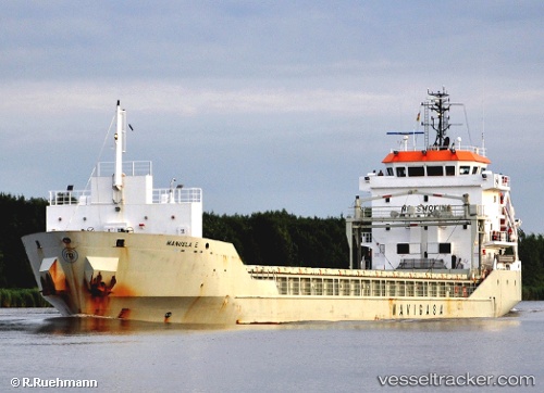
 Manuela E
Current Status
Where is the vessel?
Manuela E is currently in 145 nm SW of Jarjis, based on AIS data received about 1272d ago.
Latest AIS update:
Current position: 32.31644° N, 13.59971° W (145 nm SW of Jarjis)
Average speed (last 7 days): Loading…
Average speed (last 30 days): Loading…
Vessel profile: Manuela E is a Multi Purpose Carrier with dimensions 100m x 14m.
This page combines live AIS, route history, probable destination signals, nearby traffic, and port activity for practical vessel monitoring.
The current position of vessel Manuela E is 32.31644 lat / -13.59971 lng. Updated: 2022-12-31 21:46:01 UTCNearest reference points:
- 148 nm SE of Porto Santo Island
- 109 nm E of Porto Santo Island
- 101 nm SW of Jarjis
Currently sailing under the flag of Spain ![]()
Manuela E built in 2007 year
Deadweight:
5000 tDetails:
Live Vessel Manuela E Analytics (details, animations, etc.)
Recent AIS points (UTC):
2022-12-31 21:46:01 UTC · 32.31644, -13.59971 · SOG 10.5 kn · COG 22°