 vesseltracker.com
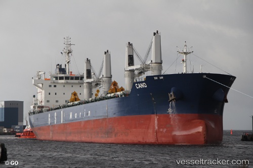
 Cano
Cano
Current Status
Where is the vessel?
Cano is currently in Near Sacramento, based on AIS data received less than 1h ago.
Latest AIS update:
Current position: 38.56165° N, 121.55952° W (Near Sacramento)
Average speed (last 7 days): Loading…
Average speed (last 30 days): Loading…
Vessel profile: Cano is a Bulk Carrier with dimensions 186m x 28m.
This page combines live AIS, route history, probable destination signals, nearby traffic, and port activity for practical vessel monitoring.
The current position of vessel Cano is 38.56165 lat / -121.55952 lng. Updated: 2026-05-14 19:59:26 UTCNearest reference points:
- Near Isleton
- Near Benicia
- Near VALLEJO
Currently sailing under the flag of Malta ![]()
Cano built in 2013 year
Deadweight:
38980 tDetails:
Live Vessel Cano Analytics (details, animations, etc.)
Recent AIS points (UTC):
2026-05-14 16:44:26 UTC · 38.56164, -121.55956 · SOG 0 kn · COG 261°2026-05-14 18:11:26 UTC · 38.56164, -121.55955 · SOG 0 kn · COG 261°
2026-05-14 19:56:26 UTC · 38.56165, -121.55957 · SOG 0 kn · COG 261°
2026-05-14 19:59:26 UTC · 38.56165, -121.55952 · SOG 0.1 kn · COG 261°