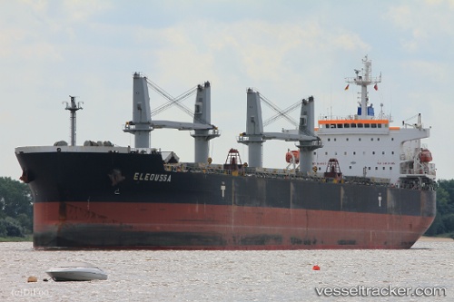
 Eleoussa
Current Status
Where is the vessel?
Eleoussa is currently in Near Mombasa, based on AIS data received about 14h ago.
Latest AIS update:
Current position: 4.05961° S, 39.64298° E (Near Mombasa)
Average speed (last 7 days): Loading…
Average speed (last 30 days): Loading…
Vessel profile: Eleoussa is a Bulk Carrier with dimensions 190m x 190m.
This page combines live AIS, route history, probable destination signals, nearby traffic, and port activity for practical vessel monitoring.
The current position of vessel Eleoussa is -4.05961 lat / 39.64298 lng. Updated: 2026-06-22 15:38:37 UTCNearest reference points:
- Near Mombasa
- 11 nm SE of Mombasa
Currently sailing under the flag of Malta ![]()
Eleoussa built in 2008 year
Deadweight:
56678 tDetails:
Live Vessel Eleoussa Analytics (details, animations, etc.)
Recent AIS points (UTC):
2026-06-22 11:56:38 UTC · -4.05957, 39.64299 · SOG 0 kn · COG 345°2026-06-22 13:23:37 UTC · -4.05956, 39.64301 · SOG 0 kn · COG 344°
2026-06-22 14:05:40 UTC · -4.05955, 39.64300 · SOG 0 kn · COG 345°
2026-06-22 15:38:37 UTC · -4.05961, 39.64298 · SOG 0 kn · COG 344°