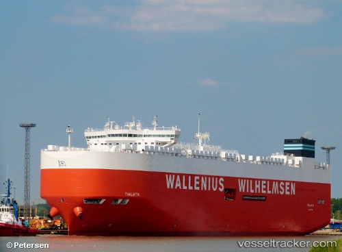
 Thalatta
Current Status
Where is the vessel?
Thalatta is currently in 59 nm SW of Avalon, based on AIS data received about 14h ago.
Latest AIS update:
Current position: 32.46236° N, 118.86606° W (59 nm SW of Avalon)
Average speed (last 7 days): Loading…
Average speed (last 30 days): Loading…
Vessel profile: Thalatta is a Vehicles Carrier with dimensions 200m x 37m.
This page combines live AIS, route history, probable destination signals, nearby traffic, and port activity for practical vessel monitoring.
The current position of vessel Thalatta is 32.46236 lat / -118.86606 lng. Updated: 2026-06-15 05:09:10 UTCNearest reference points:
- 12 nm SW of Avalon
- 17 nm S of Avalon
- 35 nm W of Del Mar, San Diego
Currently sailing under the flag of Malta ![]()
Details:
Live Vessel Thalatta Analytics (details, animations, etc.)
Recent AIS points (UTC):
2026-06-15 02:23:40 UTC · 32.46320, -118.88922 · SOG 4.4 kn · COG 318°2026-06-15 02:30:59 UTC · 32.46693, -118.89530 · SOG 2.2 kn · COG 298°
2026-06-15 03:25:30 UTC · 32.46908, -118.88270 · SOG 1 kn · COG 9°
2026-06-15 05:09:10 UTC · 32.46236, -118.86606 · SOG 0.3 kn · COG 32°