 vesseltracker.com
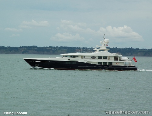
 Deniki
Current Status
Where is the vessel?
Deniki is currently in 10 nm SE of Boulouris-sur-Mer, based on AIS data received less than 1h ago.
Latest AIS update:
Current position: 43.32689° N, 7.00026° E (10 nm SE of Boulouris-sur-Mer)
Average speed (last 7 days): Loading…
Average speed (last 30 days): Loading…
Vessel profile: Deniki is a Service Ship with dimensions 52m x 10m.
This page combines live AIS, route history, probable destination signals, nearby traffic, and port activity for practical vessel monitoring.
The current position of vessel Deniki is 43.32689 lat / 7.00026 lng. Updated: 2026-05-13 12:01:58 UTCNearest reference points:
- Near Théoule-sur-Mer
- Near Boulouris-sur-Mer
- Near Saint-Tropez
Currently sailing under the flag of Malta ![]()
Deniki built in 2007 year
Details:
Live Vessel Deniki Analytics (details, animations, etc.)
Recent AIS points (UTC):
2026-05-13 05:37:14 UTC · 43.17204, 5.60824 · SOG 0 kn · COG 224°2026-05-13 09:46:47 UTC · 42.98747, 6.50629 · SOG 13.4 kn · COG 64°
2026-05-13 10:49:38 UTC · 43.12055, 6.76108 · SOG 13.6 kn · COG 41°
2026-05-13 12:01:58 UTC · 43.32689, 7.00026 · SOG 13 kn · COG 37°