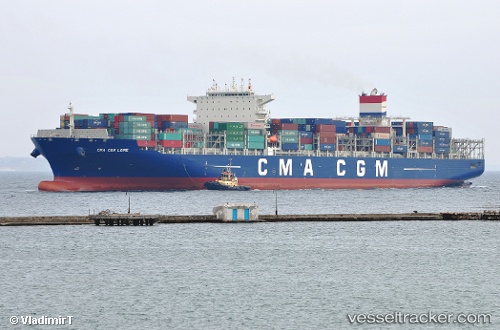
 Cma Cgm Loire
Current Status
Where is the vessel?
Cma Cgm Loire is currently in 47 nm SW of Dakar, based on AIS data received about 16h ago.
Latest AIS update:
Current position: 13.98659° N, 17.79893° W (47 nm SW of Dakar)
Average speed (last 7 days): Loading…
Average speed (last 30 days): Loading…
Vessel profile: Cma Cgm Loire is a Container Ship with dimensions 300m x 49m.
This page combines live AIS, route history, probable destination signals, nearby traffic, and port activity for practical vessel monitoring.
The current position of vessel Cma Cgm Loire is 13.98659 lat / -17.79893 lng. Updated: 2026-06-23 07:26:08 UTCNearest reference points:
- Near Dakar
- Near Rufisque
- Near Banjul
Currently sailing under the flag of Malta ![]()
Details:
Live Vessel Cma Cgm Loire Analytics (details, animations, etc.)
Recent AIS points (UTC):
2026-06-23 04:22:31 UTC · 12.99521, -17.72402 · SOG 19.9 kn · COG -1°2026-06-23 06:25:33 UTC · 13.66079, -17.77192 · SOG 19.1 kn · COG 357°
2026-06-23 07:05:15 UTC · 13.87427, -17.78441 · SOG 19.4 kn · COG 352°
2026-06-23 07:26:08 UTC · 13.98659, -17.79893 · SOG 19.2 kn · COG 352°