 vesseltracker.com
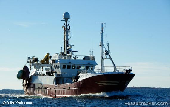
 Santos
Current Status
Where is the vessel?
Santos is currently in Near Miiduranna, based on AIS data received less than 1h ago.
Latest AIS update:
Current position: 59.49865° N, 24.81461° E (Near Miiduranna)
Average speed (last 7 days): Loading…
Average speed (last 30 days): Loading…
Vessel profile: Santos is a Fishing Vessel with dimensions 32m x 8m.
This page combines live AIS, route history, probable destination signals, nearby traffic, and port activity for practical vessel monitoring.
The current position of vessel Santos is 59.49865 lat / 24.81461 lng. Updated: 2026-05-14 21:37:40 UTCNearest reference points:
- Near Vanasadam
- Near Aegna
- Near Nurme
Currently sailing under the flag of Finland ![]()
Details:
Live Vessel Santos Analytics (details, animations, etc.)
Recent AIS points (UTC):
2026-05-14 18:22:41 UTC · 59.49864, 24.81461 · SOG 0 kn · COG 148°2026-05-14 19:40:41 UTC · 59.49865, 24.81461 · SOG 0 kn · COG 149°
2026-05-14 19:49:40 UTC · 59.49864, 24.81458 · SOG 0 kn · COG 147°
2026-05-14 21:37:40 UTC · 59.49865, 24.81461 · SOG 0 kn · COG 148°