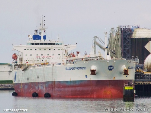
 Hellespont Progress
Current Status
Where is the vessel?
Hellespont Progress is currently in Near TUZLA, based on AIS data received about 14h ago.
Latest AIS update:
Current position: 40.84362° N, 29.27010° E (Near TUZLA)
Average speed (last 7 days): Loading…
Average speed (last 30 days): Loading…
Vessel profile: Hellespont Progress is a Crude Oil Tanker with dimensions 228m x 32m.
This page combines live AIS, route history, probable destination signals, nearby traffic, and port activity for practical vessel monitoring.
The current position of vessel Hellespont Progress is 40.84362 lat / 29.27010 lng. Updated: 2026-06-30 05:37:34 UTCNearest reference points:
- Near TUZLA
- Near PENDIK
- Near Tuzla Free Zone
Currently sailing under the flag of United Kingdom ![]()
Hellespont Progress built in 2006 year
Deadweight:
73727 tDetails:
Live Vessel Hellespont Progress Analytics (details, animations, etc.)
Recent AIS points (UTC):
2026-06-30 02:40:35 UTC · 40.84363, 29.27012 · SOG 0 kn · COG 220°2026-06-30 04:22:34 UTC · 40.84363, 29.27010 · SOG 0 kn · COG 220°
2026-06-30 04:31:35 UTC · 40.84362, 29.27008 · SOG 0 kn · COG 220°
2026-06-30 05:37:34 UTC · 40.84362, 29.27010 · SOG 0 kn · COG 220°