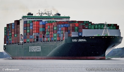
 Ever Liberal
Current Status
Where is the vessel?
Ever Liberal is currently in 59 nm S of Seogwipo, based on AIS data received about 15h ago.
Latest AIS update:
Current position: 32.31499° N, 126.98445° E (59 nm S of Seogwipo)
Average speed (last 7 days): Loading…
Average speed (last 30 days): Loading…
Vessel profile: Ever Liberal is a Container Ship with dimensions 334m x 46m.
This page combines live AIS, route history, probable destination signals, nearby traffic, and port activity for practical vessel monitoring.
The current position of vessel Ever Liberal is 32.31499 lat / 126.98445 lng. Updated: 2026-06-05 00:47:18 UTCNearest reference points:
- 63 nm SE of Seogwipo
- 78 nm S of Seogwipo
- 78 nm SE of Seogwipo
Currently sailing under the flag of United Kingdom ![]()
Details:
Live Vessel Ever Liberal Analytics (details, animations, etc.)
Recent AIS points (UTC):
2026-06-05 00:47:18 UTC · 32.31499, 126.98445 · SOG 17.8 kn · COG 51°2026-06-05 00:47:18 UTC · 32.31499, 126.98445 · SOG 17.8 kn · COG 51°
2026-06-05 00:47:18 UTC · 32.31499, 126.98445 · SOG 17.8 kn · COG 51°
2026-06-05 00:47:18 UTC · 32.31499, 126.98445 · SOG 17.8 kn · COG 51°