 vesseltracker.com
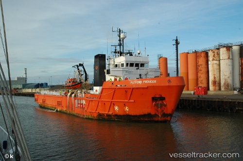
 Putford Provider
Current Status
Where is the vessel?
Putford Provider is currently in Near Leith, based on AIS data received about 1113d ago.
Latest AIS update:
Current position: 55.98383° N, 3.17250° W (Near Leith)
Average speed (last 7 days): Loading…
Average speed (last 30 days): Loading…
Vessel profile: Putford Provider is a Offshore Tug Supply Ship with dimensions 62m x 15m.
This page combines live AIS, route history, probable destination signals, nearby traffic, and port activity for practical vessel monitoring.
The current position of vessel Putford Provider is 55.98383 lat / -3.17250 lng. Updated: 2023-03-24 06:27:35 UTCNearest reference points:
- Near Leith
- Near BROUGHTY FERRY
- Near North Berwick
Currently sailing under the flag of United Kingdom ![]()
Putford Provider built in 1983 year
Deadweight:
2036 tDetails:
Live Vessel Putford Provider Analytics (details, animations, etc.)
Recent AIS points (UTC):
2023-03-24 06:27:35 UTC · 55.98383, -3.17250 · SOG 0 kn · COG 341°