 vesseltracker.com
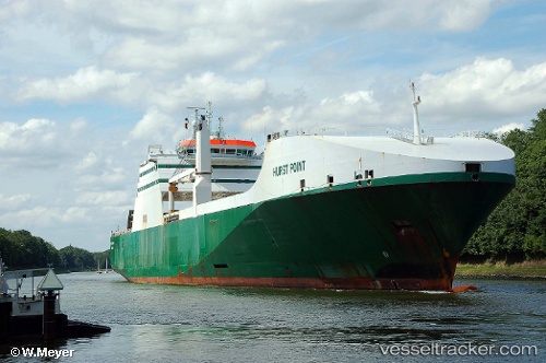
Hurst Point
Current StatusWhere is the vessel?
Hurst Point is currently in Near Worth Matravers, based on AIS data received less than 1h ago.
Latest AIS update:
Current position: 50.51286° N, 2.12520° W (Near Worth Matravers)
Average speed (last 7 days): Loading…
Average speed (last 30 days): Loading…
Vessel profile: Hurst Point is a Ro Ro Cargo Ship with dimensions 26m x 193m.
This page combines live AIS, route history, probable destination signals, nearby traffic, and port activity for practical vessel monitoring.
The current position of vessel Hurst Point is 50.51286 lat / -2.12520 lng. Updated: 2026-04-30 19:12:09 UTCNearest reference points:
- Near Poole
- Near Castletown
- Near WEYMOUTH
Details:
Live Vessel Hurst Point Analytics (details, animations, etc.)
Recent AIS points (UTC):
2026-04-30 16:24:12 UTC · 50.57249, -2.43874 · SOG 0 kn · COG 69°2026-04-30 16:54:34 UTC · 50.57250, -2.43876 · SOG 0 kn · COG 68°
2026-04-30 18:24:35 UTC · 50.54862, -2.24304 · SOG 6.9 kn · COG 115°
2026-04-30 19:12:09 UTC · 50.51286, -2.12520 · SOG 6.1 kn · COG 353°