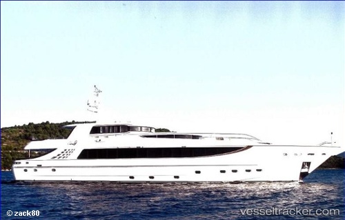
Cloud 9
Current StatusWhere is the vessel?
Cloud 9 is currently in Near Jebel Ali Free Zone, based on AIS data received about 15h ago.
Latest AIS update:
Current position: 24.98839° N, 55.02554° E (Near Jebel Ali Free Zone)
Average speed (last 7 days): Loading…
Average speed (last 30 days): Loading…
Vessel profile: Cloud 9 is a Service Ship with dimensions 8m x 40m.
This page combines live AIS, route history, probable destination signals, nearby traffic, and port activity for practical vessel monitoring.
The current position of vessel Cloud 9 is 24.98839 lat / 55.02554 lng. Updated: 2026-05-19 16:02:20 UTCNearest reference points:
- Near Jebel Ali Free Zone
- Near Jebel Ali
- Near DUBAI MARINA
Details:
Live Vessel Cloud 9 Analytics (details, animations, etc.)
Recent AIS points (UTC):
2026-05-19 13:45:08 UTC · 25.41913, 55.09536 · SOG 0 kn · COG -1°2026-05-19 13:45:08 UTC · 25.41913, 55.09536 · SOG 0 kn · COG -1°
2026-05-19 15:42:18 UTC · 24.98839, 55.02554 · SOG 0 kn · COG -1°
2026-05-19 16:02:20 UTC · 24.98839, 55.02554 · SOG 0 kn · COG -1°