 vesseltracker.com
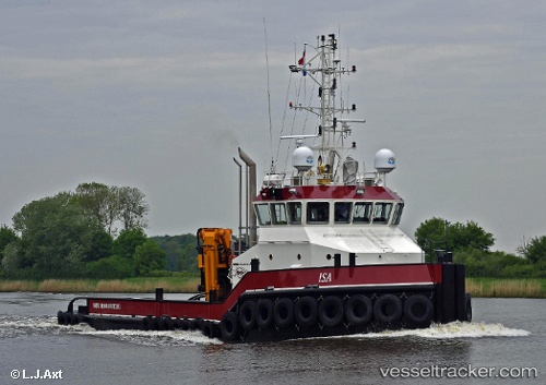
 ELISA
ELISA
Current Status
Where is the vessel?
ELISA is currently in Near Felixstowe, based on AIS data received less than 1h ago.
Latest AIS update:
Current position: 51.95517° N, 1.30649° E (Near Felixstowe)
Average speed (last 7 days): Loading…
Average speed (last 30 days): Loading…
Vessel profile: ELISA is a Tug with dimensions m x m.
This page combines live AIS, route history, probable destination signals, nearby traffic, and port activity for practical vessel monitoring.
The current position of vessel ELISA is 51.95517 lat / 1.30649 lng. Updated: 2026-04-23 16:10:52 UTCNearest reference points:
- Near Felixstowe
- Near Dovercourt
- Near Harwich
Currently sailing under the flag of Gibraltar ![]()
Details:
Live Vessel ELISA Analytics (details, animations, etc.)
Recent AIS points (UTC):
2026-04-23 13:39:11 UTC · 51.94616, 1.39591 · SOG 2.7 kn · COG 29°2026-04-23 13:44:22 UTC · 51.94856, 1.39976 · SOG 2.7 kn · COG 71°
2026-04-23 16:10:38 UTC · 51.95517, 1.30649 · SOG 0 kn · COG 296°
2026-04-23 16:10:52 UTC · 51.95517, 1.30649 · SOG 0 kn · COG 297°