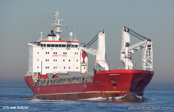
Hudsongracht
Current StatusWhere is the vessel?
Hudsongracht is currently in Near Vlaardingen, based on AIS data received about 14h ago.
Latest AIS update:
Current position: 51.89666° N, 4.33768° E (Near Vlaardingen)
Average speed (last 7 days): Loading…
Average speed (last 30 days): Loading…
Vessel profile: Hudsongracht is a Multi Purpose Carrier with dimensions 21m x 138m.
This page combines live AIS, route history, probable destination signals, nearby traffic, and port activity for practical vessel monitoring.
The current position of vessel Hudsongracht is 51.89666 lat / 4.33768 lng. Updated: 2026-05-24 20:06:43 UTCNearest reference points:
- Near VLAARDINGEN - ROTTERDAM
- Near VONDELINGENPLAAT - ROTTERDAM
- Near Vlaardingen
Details:
Live Vessel Hudsongracht Analytics (details, animations, etc.)
Recent AIS points (UTC):
2026-05-24 16:15:40 UTC · 51.89666, 4.33785 · SOG 0 kn · COG 75°2026-05-24 17:21:41 UTC · 51.89663, 4.33772 · SOG 0 kn · COG 74°
2026-05-24 19:27:52 UTC · 51.89660, 4.33764 · SOG 0 kn · COG 75°
2026-05-24 20:06:43 UTC · 51.89666, 4.33768 · SOG 0 kn · COG 74°