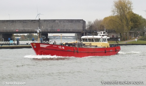
 Ye 19 Johanna k
Current Status
Where is the vessel?
Ye 19 Johanna k is currently in Near HARLINGEN, based on AIS data received about 14h ago.
Latest AIS update:
Current position: 53.17016° N, 5.41213° E (Near HARLINGEN)
Average speed (last 7 days): Loading…
Average speed (last 30 days): Loading…
Vessel profile: Ye 19 Johanna k is a Fishing Vessel with dimensions 36m x 8m.
This page combines live AIS, route history, probable destination signals, nearby traffic, and port activity for practical vessel monitoring.
The current position of vessel Ye 19 Johanna k is 53.17016 lat / 5.41213 lng. Updated: 2026-05-22 20:00:42 UTCNearest reference points:
- Near HARLINGEN
- Near FRANEKER
- Near Wonseradeel/Makkum
Currently sailing under the flag of Netherlands ![]()
Ye 19 Johanna k built in 1995 year
Details:
Live Vessel Ye 19 Johanna k Analytics (details, animations, etc.)
Recent AIS points (UTC):
2026-05-22 16:39:41 UTC · 53.17016, 5.41214 · SOG 0 kn · COG 313°2026-05-22 17:26:29 UTC · 53.17016, 5.41214 · SOG 0 kn · COG 314°
2026-05-22 19:21:40 UTC · 53.17018, 5.41213 · SOG 0 kn · COG 314°
2026-05-22 20:00:42 UTC · 53.17016, 5.41213 · SOG 0 kn · COG 314°