 vesseltracker.com
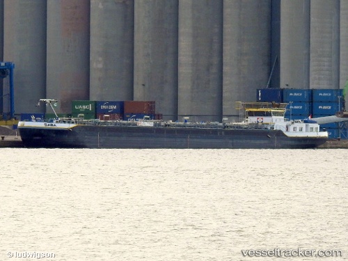
 Saba
Saba
Current Status
Where is the vessel?
Saba is currently in Near Vlaardingen, based on AIS data received less than 1h ago.
Latest AIS update:
Current position: 51.88872° N, 4.31711° E (Near Vlaardingen)
Average speed (last 7 days): Loading…
Average speed (last 30 days): Loading…
Vessel profile: Saba is a Chemical Oil Products Tanker with dimensions 86m x 10m.
This page combines live AIS, route history, probable destination signals, nearby traffic, and port activity for practical vessel monitoring.
The current position of vessel Saba is 51.88872 lat / 4.31711 lng. Updated: 2026-05-15 13:06:34 UTCNearest reference points:
- Near Vlaardingen
- Near VLAARDINGEN - ROTTERDAM
- Near BOTLEK - ROTTERDAM
Currently sailing under the flag of Netherlands ![]()
Details:
Live Vessel Saba Analytics (details, animations, etc.)
Recent AIS points (UTC):
2026-05-15 09:57:27 UTC · 51.88871, 4.31709 · SOG 0 kn · COG -1°2026-05-15 10:15:26 UTC · 51.88871, 4.31710 · SOG 0 kn · COG -1°
2026-05-15 11:42:36 UTC · 51.88869, 4.31709 · SOG 0 kn · COG -1°
2026-05-15 13:06:34 UTC · 51.88872, 4.31711 · SOG 0 kn · COG -1°